
Multi-Agent Path Planning for Level Set Estimation
Summary
This project introduces a decentralized path planning framework for multi-agent UAV teams performing level set estimation (LSE). By leveraging differential flatness and B-spline trajectory parameterization, the algorithm produces smooth, informative paths that are both kinematically feasible and highly effective at estimating complex region boundaries.
Figure
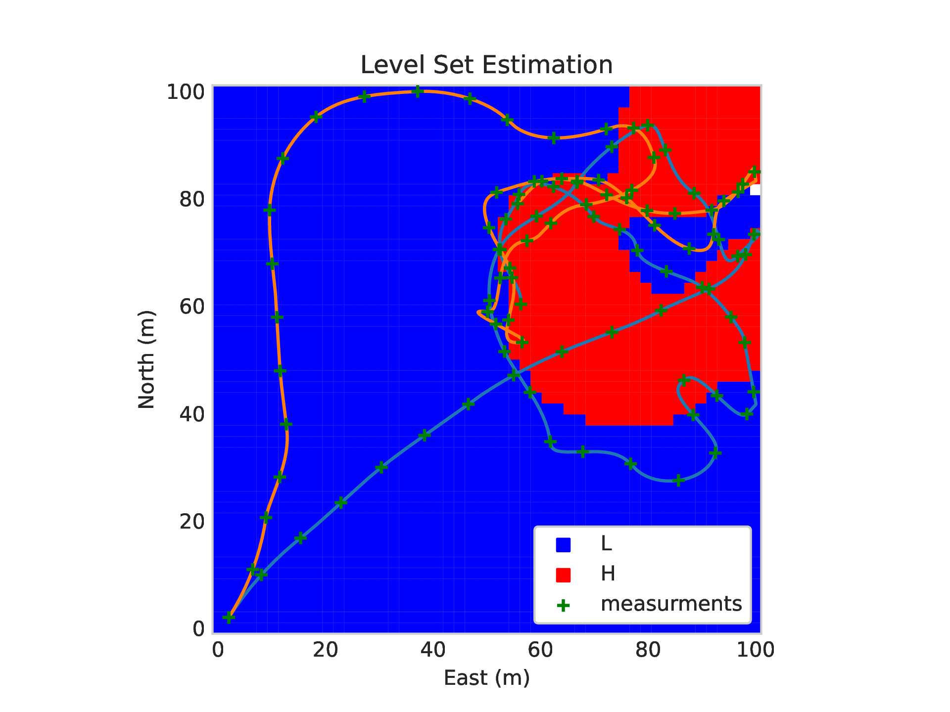
Figure: Example paths generated by multi-agent LSE planning algorithm.
Video
Abstract
In this letter, we present a decentralized multi-agent path planning algorithm for level set estimation (LSE) and environmental monitoring missions. The planned paths are parameterized using B-splines and optimized using a novel objective function designed for LSE path planning that accounts for the exploration/exploitation trade-off while allowing the use of a gradient-based optimizer. We use the differential flatness property of the unicycle model to formulate constraints for our path optimization that ensure planned paths are kinematically feasible. We also employ a block coordinate ascent (BCA) algorithm that enables multi-agent coordination in exploring the environment. Finally, we present simulation and hardware results validating our approach.
Citation
G. Stagg and C. K. Peterson,
“Multi-Agent Path Planning for Level Set Estimation Using B-Splines and Differential Flatness”,
IEEE Robotics and Automation Letters, vol. 9, no. 5, pp. 4758–4765, May 2024.
DOI: 10.1109/LRA.2024.3384763
PDF